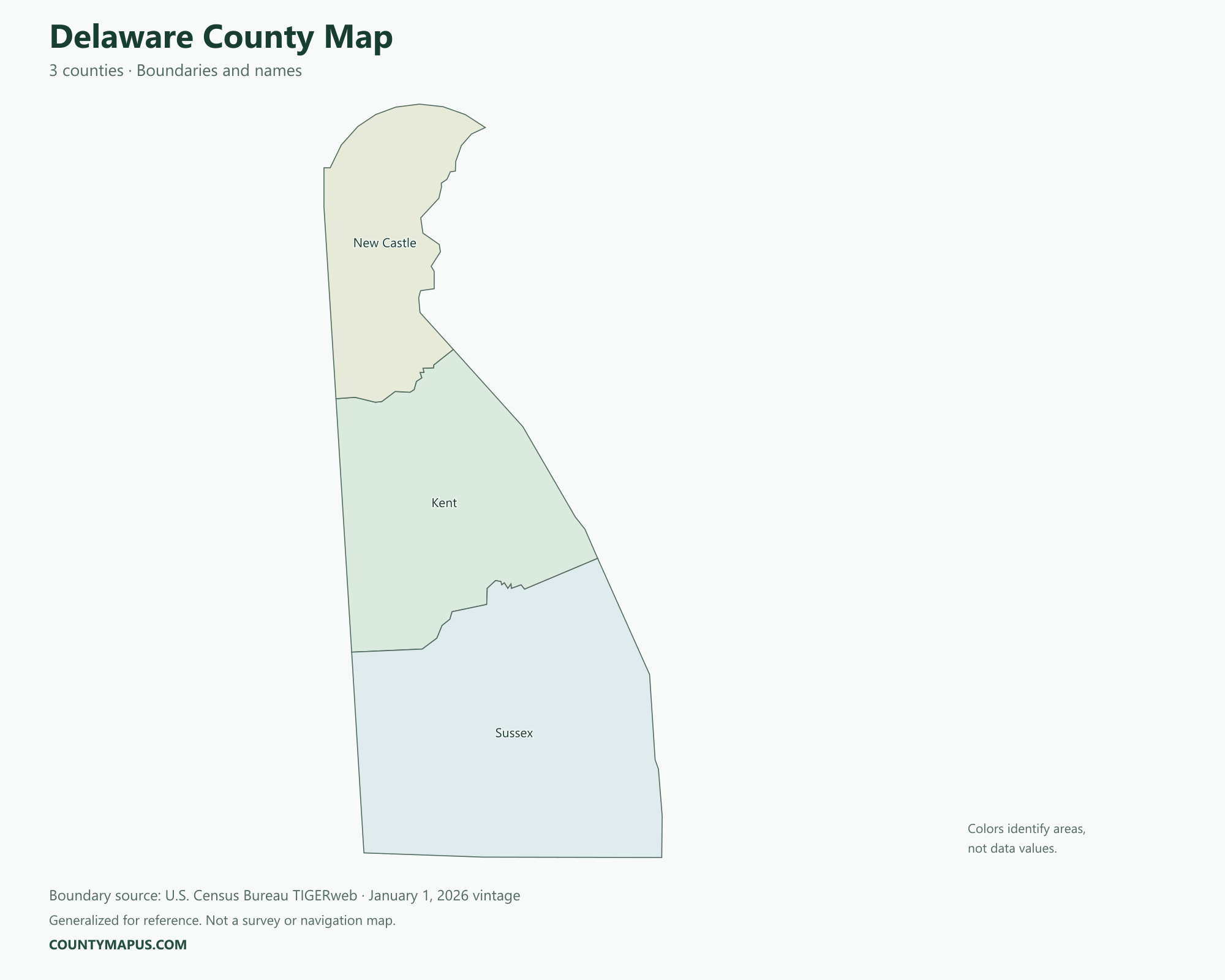
Delaware has three counties: New Castle, Kent and Sussex. New Castle occupies the north of the state, Kent the central area, and Sussex the south. This Delaware county map helps you place Wilmington, Dover and Georgetown in their county context. Use the state overview, labeled map and complete county table below for geographic reference.
Delaware State Overview
Feature
Details
State Name
Delaware
State Abbreviation
DE
Capital City
Dover
County-level Areas
3 counties
Population (2020 Census)
989,948
Land Area (2020 Census)
1,948.58 square miles
Delaware County Map
Delaware’s short county list makes it possible to show every county in one map and population table. County boundaries are separate from municipal limits: a place such as Dover is a city within a county, while Kent is the surrounding county-level area. The map follows Census county boundaries, including Delaware’s northern curved boundary and eastern coast.
U.S. Census Bureau TIGERweb county boundaries, January 1, 2026 vintage. Colors distinguish areas; they do not represent population.
Top Counties in Delaware (Population & County Seat)
Population comparisons below use the April 1, 2020 Census. They are census counts, not current estimates. Using the same year makes the county comparisons consistent.
County / Equivalent
County Seat / Government Center
Population — 2020 Census
New Castle County
Wilmington
570,719
Sussex County
Georgetown
237,378
Kent County
Dover
181,851
All three Delaware counties appear in this table.
Download Delaware State Map (Hi-Res)
Format
Download
PNG Map
Download Now
PDF Printable
Download Now
SVG Editable
Download Now
GIS Shapefile (ZIP)
Download Now
Full List of Delaware Counties (Alphabetical)
Kent County
New Castle County
Sussex County
FAQs: Delaware Counties
❓ How many counties are in Delaware? Delaware has 3 counties. All county-level areas are identified on this map.
❓ What is the capital of Delaware? Dover is the state capital.
❓ Which county had the largest population in the 2020 Census? New Castle County had 570,719 residents in the 2020 Census. Its county seat or government center is Wilmington.
❓ What is the largest county in Delaware by land area? Sussex County has the greatest land area in the Census boundary dataset. Land area and population rankings measure different things.
❓ What county is Wilmington in? Wilmington is in New Castle County, in northern Delaware.
❓ What county is Dover in? Dover, Delaware’s capital, is in Kent County.
❓ What county is Georgetown in? Georgetown is the county seat of Sussex County.
❓ Are New Castle County and the city of New Castle the same place? No. New Castle County is the county-level area; the city of New Castle is a municipality within it. Wilmington is the county seat.
❓ How should I use this county map? Use a county name or a known county seat to identify the area, then follow its boundary to neighboring counties. City limits and county boundaries are different. This reference map does not show property lines or road navigation.