Washington County Map & State Guide

Washington has 39 counties. Use the labeled map below to find county boundaries and names. This state hub brings together county geography and our published Washington guides.

StateCapitalCounty-level areas
WashingtonOlympia39 counties

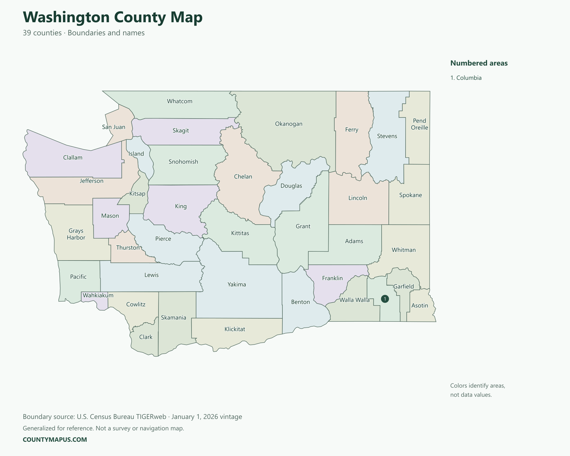
Washington County Map

Washington county map showing all 39 county-level areas and their names
U.S. Census Bureau TIGERweb county boundaries, January 1, 2026 vintage. Colors distinguish areas; they do not represent population.


Washington State Articles

County Names

  • Adams County
  • Asotin County
  • Benton County
  • Chelan County
  • Clallam County
  • Clark County
  • Columbia County
  • Cowlitz County
  • Douglas County
  • Ferry County
  • Franklin County
  • Garfield County
  • Grant County
  • Grays Harbor County
  • Island County
  • Jefferson County
  • King County
  • Kitsap County
  • Kittitas County
  • Klickitat County
  • Lewis County
  • Lincoln County
  • Mason County
  • Okanogan County
  • Pacific County
  • Pend Oreille County
  • Pierce County
  • San Juan County
  • Skagit County
  • Skamania County
  • Snohomish County
  • Spokane County
  • Stevens County
  • Thurston County
  • Wahkiakum County
  • Walla Walla County
  • Whatcom County
  • Whitman County
  • Yakima County

Boundary source: U.S. Census Bureau TIGERweb, January 1, 2026 vintage. This generalized map is for geographic reference. Browse all state maps.